Isle of Skye Loop: Ultimate Guide to the Trotternish Route
Embarking on the isle of skye loop is widely considered one of the greatest road trips in the United Kingdom, offering a breathtaking journey through surreal landscapes shaped by ancient geological activity and dramatic coastal erosion. Centered around the rugged Trotternish Peninsula in the northernmost part of the island, this roughly 50-mile circular route begins and ends in the vibrant harbor town of Portree. From soaring volcanic basalt columns and cascading waterfalls to hidden valley fairy realms and fossil-rich beaches, the circuit packs an astonishing array of natural wonders into a relatively short drive. However, mastering this Scottish Highland adventure requires more than just turning the ignition; navigating narrow single-track roads, understanding optimal travel directions, and planning your daily stops are essential for a seamless trip. Whether you are driving a compact rental car, a nimble campervan, or a larger motorhome, this guide covers everything you need to know to experience the ultimate Trotternish route safely, efficiently, and unforgettably.
What is the Most Scenic Drive on the Isle of Skye?
When travelers search for the ultimate driving experience in the Scottish Highlands, one iconic route consistently stands out above the rest.
The Trotternish Loop, widely celebrated as the Northern Loop of Skye, serves as the premier 50-mile circular driving route on the island. Encircling the dramatic Trotternish Peninsula in the northernmost part of the Isle of Skye, this breathtaking journey treats motorists to some of the most striking geological formations and coastal panoramas in the British Isles. While the continuous drive from start to finish takes roughly 1.5 hours without any interruptions, treating it as a quick sprint entirely misses the point. To properly experience the sweeping viewpoints, short coastal walks, and world-class geological landmarks, this route must be treated as a full single-day itinerary.
The loop seamlessly connects a network of well-paved main roads and scenic local routes, utilizing the A855, the A87, and minor local roads. Because of this accessible infrastructure, the journey is suitable for standard cars, campervans, and motorhomes alike. However, drivers of larger vehicles should remain mindful of changing road conditions and take their time navigating the terrain.
Advise starting the journey early in the morning to beat the peak midday crowds at major attractions along the peninsula.
Understanding how to approach this magnificent 50-mile circuit is the first step toward crafting an unforgettable Highland adventure.
Planning Your Isle of Skye Loop Route
Embarking on the iconic Isle of Skye loop requires more than just picking up your car keys and setting off.
Conquering the roughly 50-mile Trotternish circuit successfully demands careful logistical preparation, especially given the unique driving conditions, terrain, and weather patterns of Scotland's northernmost peninsula. Whether you are driving a compact rental car, a campervan, or a motorhome, understanding the geography of the route is essential for a smooth and stress-free journey.
Before you hit the accelerator, you need to establish where your journey begins, master the rules of highland navigation, and decide which direction will offer you the absolute best vistas while helping you dodge the peak tourist crowds. Getting these foundational elements right will transform your road trip from a frantic dash into an unforgettable Highland adventure.
Starting Base: What is the Prettiest Town on the Isle of Skye?
When embarking on the ultimate driving tour of the northern peninsula, finding the ideal starting base is essential for a seamless adventure.
Portree stands undisputed as both the traditional starting and ending point for the loop and widely considered the prettiest town on the Isle of Skye. Nestled around a natural sheltered bay, this picturesque harbor town is famous for its iconic row of brightly painted, multi-colored waterfront houses that reflect brilliantly off the calm sea. These pastel-hued buildings framed against dramatic green cliffs create one of the most photographed and recognizable scenes in the Scottish Highlands, instantly welcoming travelers to the magic of the island.
Beyond its undeniable aesthetic charm, Portree serves as the primary commercial and logistical hub for the entire island. Before venturing north into the wild, remote stretches of the Trotternish Peninsula, visitors should utilize Portree to stock up on vital supplies. It is the most reliable place to fill up your fuel tank, pick up groceries, and grab cash for automated parking meters that may not accept cards in remote areas. Furthermore, the town boasts an impressive array of cozy cafes, traditional pubs, and acclaimed seafood restaurants, making it the perfect spot to enjoy a hearty breakfast before hitting the road or a celebratory dinner after completing your circuit.
Setting off from Portree ensures you begin your journey with all modern conveniences firmly in place before trading civilization for the dramatic geological wonders of the northern loop.
Direction Strategy: Clockwise vs. Anti-Clockwise
When embarking on the iconic Isle of Skye loop, choosing the right direction for your journey makes a profound difference in your overall experience.
Taking the A855 northward out of Portree and traveling the Trotternish Peninsula in an anti-clockwise direction is widely considered the superior strategy for road trippers and photographers alike. Heading north immediately places you on the coast-hugging side of the road, offering uninterrupted, sweeping views across the Sound of Raasay toward the mainland mountains without needing to look across oncoming traffic lanes. This alignment provides a much safer and more immersive visual experience as you navigate the coastline.
Furthermore, timing your drive anti-clockwise ensures that the morning sun optimally illuminates major eastern landmarks like the Old Man of Storr and Kilt Rock. By hitting these high-traffic photography spots early in the day with the sun at your back, you avoid the harsh backlighting that afternoon travelers often face. Additionally, this pacing naturally counters the flow of most tour buses and casual travelers who typically head clockwise, allowing you to stay a step ahead of midday bottlenecks at popular viewpoints and car parks.
Driving Direction
Lighting & Views
Crowd Management
Key Advantage
Anti-Clockwise
Morning sun illuminates eastern cliffs; unobstructed coastal views on the passenger/driver side.
Ahead of the main tour bus flow; reaches major sights before peak hours.
Superior vistas, better photography lighting, and smoother parking access.
Clockwise
Afternoon sun behind western hills; coastal views require looking across traffic.
Trails behind the majority of morning travelers, leading to congested car parks.
Generally less recommended unless timing aligns with afternoon hikes.
Planning your journey against the clock is a small logistical adjustment that yields immense dividends in scenery, lighting, and tranquility.
Navigating Single-Track Roads and Parking
Mastering the practical aspects of driving and parking is essential for a stress-free journey around the Trotternish circuit.
Driving the isle of skye loop involves navigating a mix of standard roads and narrow single-track stretches where utmost patience and proper road etiquette are required. Because many sections of the A855 and surrounding coastal lanes accommodate only one vehicle width, mastering the local passing place system keeps traffic flowing smoothly and prevents frustrating standoffs. Whenever you notice a vehicle approaching from the opposite direction, or if a local driver behind you is looking to travel at a faster pace, you must be prepared to yield the right of way.
Always pull into a passing place on your left, or wait directly opposite a passing place if it is situated on your right-hand side.
Never park or abandon your vehicle inside a passing place, as these areas are strictly designated to keep the single-track roads moving.
Allow faster local traffic to overtake you by signaling and pulling over into a passing place when it is safe to do so.
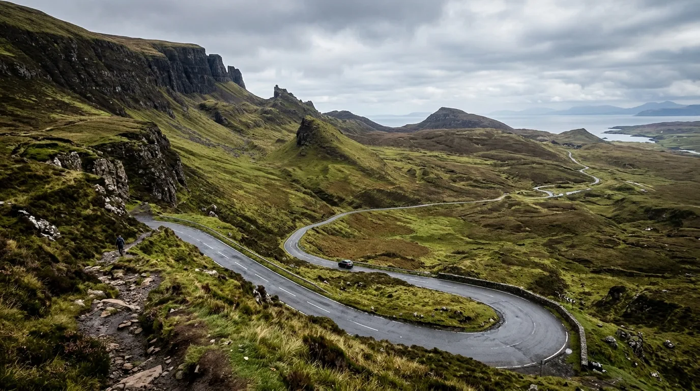
Exercise extreme caution on steep climbs and sharp descents, particularly around Uig and the dramatic terrain of the Quiraing.
Beyond road etiquette, practical planning is required for parking at major sights and trailheads along the route. High-visitor locations such as the Old Man of Storr, Kilt Rock, and the Quiraing feature designated car parks that generally require a parking fee. To ensure a smooth visit, travelers should always carry physical coins or notes for traditional honor boxes and machines, but also pre-download and set up the RingGo mobile parking application ahead of time, as cellular signal can occasionally be patchy across the more remote northern peninsulas of the island.
Respecting local driving customs and arriving prepared for parking fees ensures an enjoyable and respectful exploration of the stunning northern landscape.
Let us dive into the core logistical strategies you need to master, starting with choosing your ideal base and understanding how to navigate the roads safely.
Essential Isle of Skye Stops on the Trotternish Loop
Embarking on the Trotternish Loop reveals a succession of Scotland's most dramatic geological landmarks, unfolding in a breathtaking sequence as you travel north from Portree along the eastern coastline.
Setting out along the A855, the landscape quickly transforms into a theater of ancient volcanic activity, towering sea cliffs, and sweeping ocean vistas. Each stop along this legendary circular route offers a unique perspective on the Isle of Skye's rugged terrain, inviting travelers to step out of their vehicles and explore the natural wonders up close. From world-famous rock formations and hidden coastal waterfalls to prehistoric dinosaur footprints and mystical green valleys, the journey packs an incredible variety of sights into a relatively compact drive.
As you navigate further up the peninsula, the road weaves between the soaring escarpments of the Trotternish Ridge and the crashing waves of the Atlantic, guiding you toward unforgettable encounters with nature and history. Whether you are lacing up your hiking boots to scale legendary pinnacles or simply pausing at a coastal viewpoint to watch the seabirds, every mile of this route delivers postcard-worthy scenery. The following sequential stops detail the essential highlights awaiting you on the ultimate Trotternish loop itinerary.
Loch Fada & The Old Man of Storr
Heading north from Portree along the A855, the Trotternish Loop immediately reveals some of the most dramatic landscapes in Scotland, beginning with tranquil lochs and culminating in world-famous geological formations.
As you embark on the initial leg of the journey, your first major atmospheric stop is Loch Fada. Situated just a few miles outside Portree, this peaceful freshwater loch offers breathtaking, mirror-like reflections of the surrounding hills on a calm day. Pausing at the nearby Tobhta Uachdrach viewpoint provides a magnificent vantage point to absorb the sweeping vistas of the rugged terrain, setting the perfect tone for the adventures ahead as the road guides you further into the Trotternish Peninsula.
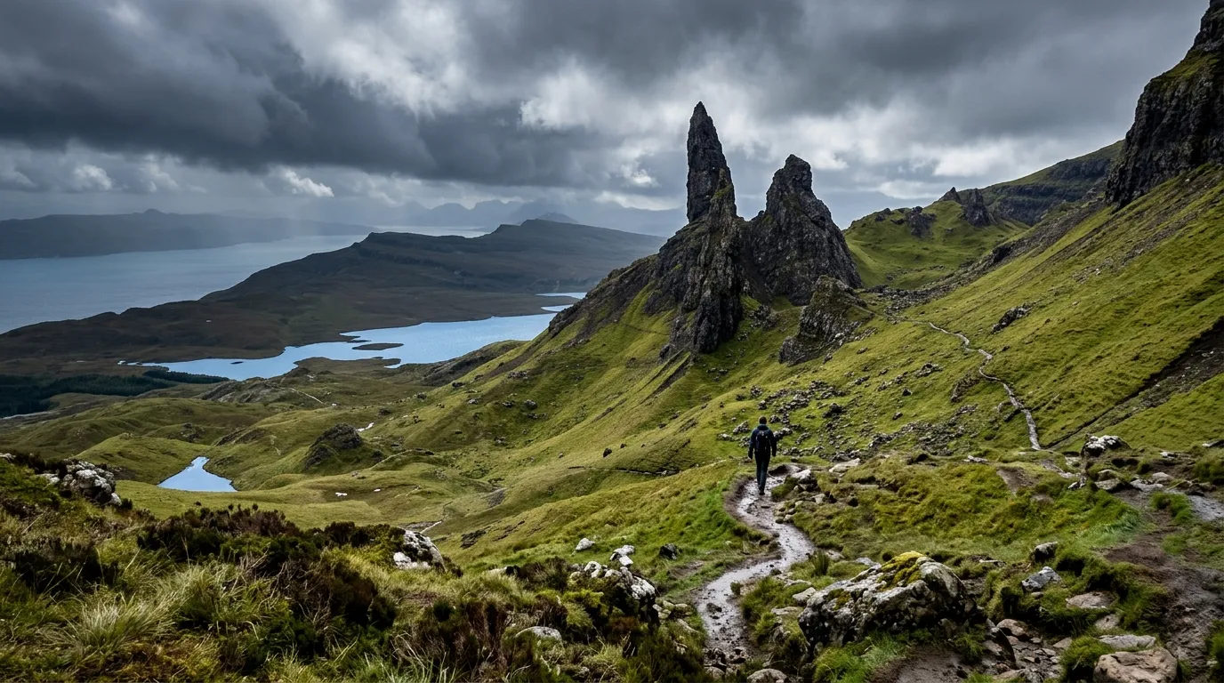
A short drive further north brings you face to face with the undisputed heavyweight of Skye's geological wonders: the Old Man of Storr. This ancient volcanic landslide ridge is dominated by a majestic, 160-foot basalt pinnacle that pierces the skyline like a jagged tooth. For travelers pressed for time or looking for a gentle introduction, the site offers striking views from the car park below. However, to truly appreciate its scale and grandeur, visitors can embark on a well-maintained, 1.5-hour round-trip hiking trail that winds its way up into the shadow of the monoliths, rewarding the climb with staggering panoramic views across the Sound of Raasay.
Leaving the formidable presence of the Storr behind, the route continues northward to unfold even more coastal wonders and hidden historical gems.
Lealt Gorge, Kilt Rock & Mealt Falls
Continuing your journey further north along the rugged Trotternish Peninsula, the coastal landscape reveals some of the most dramatic geological formations in Scotland.
Your first major stop in this stretch is Lealt Gorge and Falls, a dramatic river canyon carved out over millennia by the River Lealt as it rushes toward the sea. A well-maintained wooden viewing platform extends out over the precipice, offering visitors a secure yet heart-pounding vantage point to look down into the roaring gorge. Here, the churning water carves its way through ancient volcanic layers before emptying into the Atlantic. A short stroll away down the cliffside path leads to the fascinating ruins of an old salmon bothy, a historic reminder of the area's maritime and fishing heritage when locals harvested fish from the turbulent waters below.
Just a short drive further up the A855 brings you to one of the most photographed and instantly recognizable landmarks on the entire island: Kilt Rock and Mealt Falls. Kilt Rock derives its evocative name from its striking geological resemblance to a traditional Scottish kilt, formed entirely of vertical basalt columns resting on a base of sandstone sill. The regular, pleated vertical fractures in the rock mimic the woven tartan folds of fabric, creating a breathtaking natural tapestry of charcoal greys, golds, and deep browns.
Cascading directly over the edge of these 200-foot basalt sea columns is Mealt Falls, a spectacular waterfall fed by nearby Loch Mealt. The water plunges in a single, uninterrupted drop directly off the cliff face into the churning Atlantic Ocean far below. On windy days—which are frequent on the exposed coast—the strong sea breezes catch the plunging water, blowing the spray upward into a misty cloud before it ever reaches the sea. A safe, fenced viewing area right off the main parking lot makes this a wonderfully accessible stop, complete with an automated audio point that shares local folklore and geological facts in multiple languages.
These stunning coastal marvels provide an unforgettable taste of Skye's raw geological power before the route leads you onward to hidden beaches and ancient footprints.
Staffin Harbour & An Corran Beach Dinosaur Footprints
Continuing further up the eastern coastline of the Trotternish Peninsula, the route leads travelers toward the picturesque coastal community of Staffin.
Staffin Harbour serves as a charming maritime stop along the loop, offering a glimpse into the local fishing heritage and dramatic coastal scenery that defines this part of the island. The small, sheltered harbor is surrounded by rugged cliffs and provides sweeping views out toward the Atlantic Ocean and the nearby islands. It is a fantastic location to pause your journey, stretch your legs, and appreciate the raw, untouched beauty of the Skye coastline away from the busier tourist hubs.
Just a short distance from the harbor lies An Corran Beach, a seemingly ordinary sandy shore that holds a remarkable prehistoric secret. This unassuming beach is globally renowned for being one of the few places where actual, physical evidence of prehistoric life can be seen right on the surface. Walking along the rocky shoreline here offers a rare window into the Middle Jurassic period, roughly 165 million years ago, when the Isle of Skye possessed a vastly different, much warmer climate and landscape.
Remind visitors to check local tide times before visiting An Corran Beach, as the dinosaur footprints are submerged at high tide.
The primary attraction at An Corran Beach is the presence of genuine dinosaur footprints preserved in the sandstone and rock ledges along the shore. These fossilized impressions were left behind by ornithopods—large, plant-eating dinosaurs that walked on two legs—and are particularly visible during the winter months when sand shifting exposes more of the rocky strata. Discovering these ancient tracks firsthand adds an incredible layer of prehistoric wonder to your scenic driving tour.
From Staffin Harbour and its prehistoric shore, the northern coastal adventure continues onward toward the dramatic ridges of the Quiraing.
How Do I Get to Trotternish Ridge? The Quiraing
Accessing the mesmerizing expanse of the Trotternish Ridge requires leaving the coastal route to explore one of the most remarkable inland geological features on the island.
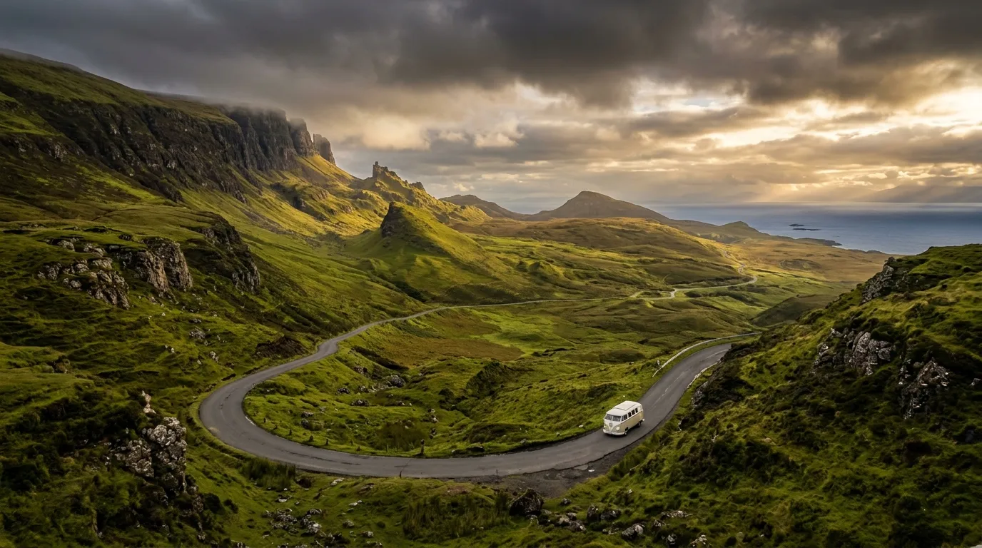
To reach the Trotternish Ridge, drivers must turn inland from the main coastal road onto a notoriously steep and winding single-track access road. This route climbs sharply into the mountains, offering breathtaking panoramic views before bringing visitors directly to the foot of the Quiraing. As an active landslip formed by centuries of geological shifts, the landscape here feels otherworldly, defined by towering cliffs, moss-covered slopes, and a labyrinth of high plateaus.
Explorers navigating this dramatic area will encounter several iconic rock formations shaped by ancient earth movements. Among the most famous landmarks are The Needle, a distinct 120-foot-tall jagged pillar of rock pointing skyward; The Prison, a massive fortress-like stone structure that looms over the trail; and The Table, a hidden flat grassy plateau surrounded by towering cliffs where locals once famously hid cattle from raiders. Tackling the terrain here demands sturdy footwear and careful attention to the weather, but the payoff is an unforgettable journey through Scotland's most legendary geological masterpiece.
Leaving the heights of the Quiraing prepares travelers to continue their journey northward toward the remote coastal landmarks and historic ruins of the peninsula.
As the Isle of Skye loop presses northward past the striking landscapes of Staffin, the Trotternish Peninsula reaches its wild and windswept apex, offering a profound journey through dramatic coastal lookouts and deeply rooted Highland history.
Continuing past Flodigarry and the rugged cliffs of Bioda Buidhe, travelers arrive at Rubha Hunish, the northernmost tip of the Isle of Skye. This remote headland is a haven for coastal walkers and wildlife enthusiasts, providing uninterrupted panoramic views across the Minch toward the Outer Hebrides. Because vehicular access is not permitted right to the headpoint, reaching the lookout requires a rewarding walk across open clifftop terrain, where minke whales, dolphins, and sea eagles are frequently spotted offshore. The journey to the very edge of the peninsula feels like stepping off the edge of the known world, surrounded by raw sea air and crashing Atlantic waves.
Just a short distance further along the coast stand the atmospheric ruins of Duntulm Castle. Perched dramatically on a sheer basalt cliff overlooking the sea, this once-imposing fortress was the historic stronghold of the MacDonalds of Sleat. Although the site is now closed to the public due to safety concerns regarding the crumbling masonry, viewing the ruins from the designated roadside areas evokes a strong sense of the clan's tumultuous past. Legend whispers that the castle was abandoned after a tragic infant accident involving a nursemaid and a high window, adding a haunting folklore layer to the already striking coastal scenery.
Rounding the peninsula toward Kilmuir brings visitors into profound contact with Scottish heritage. At the historic Kilmuir Cemetery, travelers can pay their respects at the memorial of Flora Macdonald, the celebrated Jacobite heroine who famously helped Bonnie Prince Charlie escape 'over the sea to Skye' disguised as her Irish maid after the defeat at Culloden. Her Celtic cross memorial stands as a timeless tribute to her loyalty and bravery during one of Scotland's most turbulent historical eras.
Adjacent to the historical burial grounds lies the Skye Museum of Island Life, an exceptional open-air heritage site that vividly preserves a cluster of 19th-century thatched stone crofting huts. Stepping inside these authentically restored blackhouses reveals how islanders lived, worked, and survived over 150 years ago. Complete with period furniture, traditional peat fires, and agricultural implements, the museum offers a deeply immersive glimpse into traditional Skye crofting culture before the modern era transformed the Highlands.
From the remote clifftops of Rubha Hunish to the poignant history preserved at Kilmuir, the northernmost stretch of the Trotternish loop offers a powerful connection to both the raw power of nature and the resilient spirit of the Isle of Skye.
Uig Harbour & The Fairy Glen
As the Trotternish Loop continues to round the northernmost tip and heads southward, the landscape shifts dramatically near Uig Harbour before revealing one of Skye's most magical hidden gems.
Uig Harbour serves as a vital transport hub and a picturesque coastal settlement where ferries depart for the Outer Hebrides. Nestled against steep hillsides overlooking the waters of Loch Snizort, the area marks a significant transition point on the circuit. Travelers wrapping up the northern leg of the drive will find Uig to be an ideal spot to pause, stretch their legs, and take in the maritime atmosphere before approaching the final stretch of the circular route back toward Portree.
Just a short distance away from the main village lies the Fairy Glen, an ethereal, pond-strewn valley that feels entirely removed from the rest of the world. This miniature wonderland features a surreal landscape of undulating grassy conical hills, tiny circular lochans, and intricate geological shelves that were shaped by ancient landslips. Walking through the glen reveals a hypnotic, almost otherworldly topography formed by nature without any actual mythological intervention, though its whimsical appearance easily sparks the imagination.
At the heart of the Fairy Glen stands the Fairy Castle, a natural basalt and rock tower that crowns one of the central mounds. Visitors can scramble up to the ruins of this rock formation for panoramic views across the miniature peaks and valleys below. While exploring the glen, travelers are encouraged to respect the delicate environment by sticking to established paths and avoiding the creation of stone cairns, preserving the untouched beauty of this unique landscape.
Leaving the magical confines of the glen, the final leg of the drive rejoins the main road to complete the circuit back to Portree. This effortless transition wraps up the 50-mile journey, leaving motorists with unforgettable memories of dramatic cliffs, coastal ruins, and mystical inland valleys.
Exploring Uig Harbour and the enchanting Fairy Glen provides a breathtaking finale to the iconic Trotternish Loop before returning to the vibrant atmosphere of Portree.
Prepare your camera and your sense of adventure as we break down the definitive sequence of stops, beginning right outside Portree with glassy lochs and towering rock spires.
Can You Show Me a Map of the Trotternish Loop?
Having a reliable map of the Trotternish Loop is essential for navigating the dramatic terrain of the Isle of Skye without missing any of its iconic landmarks.
When preparing for your journey, one of the most practical steps you can take is to search for a Trotternish loop map on Google Maps before you set off. Because cell service on the northern peninsula of Skye is notoriously patchy and often drops entirely in the deep glens and coastal shadows, relying on live streaming data while driving is a recipe for getting lost or missing vital turn-offs. Pre-downloading your route for offline use ensures you have continuous GPS tracking and route guidance throughout the entire excursion.
Visually tracing the loop on a physical or digital map reveals a straightforward yet breathtaking roughly 50-mile circuit. The journey begins by heading north out of Portree along the A855 coastal road, which carries you past the towering peaks of the Storr and the roaring waters of Mealt Falls. Continuing your progression around the very top of the peninsula past Staffin and Duntulm, the route eventually curves downward along the western edge, guiding you south on the A87 highway through the ferry port village of Uig and past the whimsical Fairy Glen before returning you full circle to Portree.
By familiarizing yourself with this layout ahead of time and securing an offline map, you can keep your eyes safely on the road while seamlessly navigating every majestic mile of the peninsula.
Multi-Day Itineraries: Which is Nicer, Mull or Skye?
Extending a Scottish road trip often leads travelers to weigh the merits of the Inner Hebrides' two most famous destinations: the Isle of Skye and the Isle of Mull.
While completing the famous driving loop on the Trotternish Peninsula delivers an unmatched concentration of dramatic volcanic landscapes, towering rock formations, and sweeping coastal vistas, neighboring Mull offers a strikingly different Scottish island experience. The Isle of Skye is globally renowned for its high-impact, otherworldly geology, featuring architectural marvels of nature like the Old Man of Storr, the Quiraing, and the Kilt Rock sea cliffs. For travelers whose ideal holiday revolves around iconic photography spots, invigorating mountain hikes, and sweeping geological drama, Skye stands unrivaled.
On the other hand, the Isle of Mull trades some of Skye's overwhelming dramatic flair for a quieter, more intimate encounter with wild Scotland. Mull is celebrated for its lush woodlands, expansive sandy beaches, and exceptional wildlife-watching opportunities, including regular sightings of golden eagles, white-tailed sea eagles, and marine mammals off the coast. Its colorful main hub, Tobermory, provides a charming and relaxed alternative to Skye's busier tourist centers. Ultimately, choosing between the two depends entirely on travel style: Skye is the ultimate destination for spectacular hikes and breathtaking geological formations, whereas Mull is better suited for travelers seeking tranquil coastal isolation and rich wildlife.
Both islands possess a distinct magic, but combining a rigorous driving and hiking itinerary on Skye with a peaceful island escape on Mull creates the ultimate Scottish road trip adventure.
The isle of skye loop delivers an unforgettable 50-mile journey through some of the most dramatic and otherworldly landscapes in the Scottish Highlands. By planning your trip with an anti-clockwise driving strategy, respecting single-track road etiquette, and arriving early to premier destinations like the Old Man of Storr and the Quiraing, you can completely elevate your Scottish road trip experience. Embrace the ever-changing weather, keep your camera ready, and immerse yourself in the rich geological and cultural history of the Trotternish Peninsula. To begin planning your dream Highland escape, book your Portree accommodation well in advance, download offline maps before losing mobile signal, and check local weather forecasts before setting out on the road.